In a country as large as Argentina, monitoring growing conditions in different agricultural regions is a formidable task. Significant parts of the country are dry, making water use and distribution critical. To help in this effort, supervisory control and data acquisition (SCADA) is being used to monitor and control flow through two large dams that supply water to the country’s main fruit growing regions.
This instrumentation helps balance irrigation requirements against maintaining adequate water levels in the rivers used to transport most of Argentina’s products.
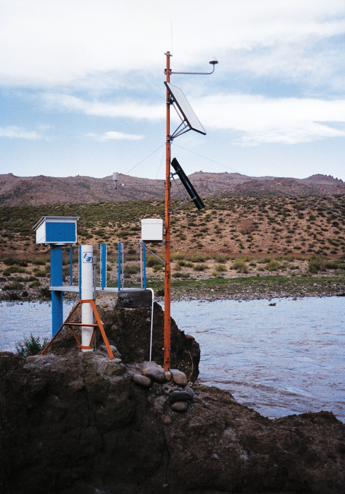
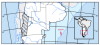
The hydrometeorological system was designed for the Autoridad Interjurisdiccional de las Cuencas de los Rios Limay, Negro y Neuquen (AIC). The AIC is responsible for managing the water supply from the Neuquen, Limay, and Negro Rivers to the country’s pomological regions. Electronica Naval, an Argentinean company based in Buenos Aires and Mar de Plata, won the contract to supply 80 stations to the AIC. The system monitors a 100,000 km2 area, the closest sites being 60 km apart and the central control station roughly 500 km from the distal sites.
One of the most pressing problems for the AIC is communicating with the remote stations. Rapid collection and exchange of meteorological information is hampered by mountainous terrain, lack of roads, and a poor telecommunications infrastructure. The communications systems (telephones, X.25 data lines) inside the country are expensive and not very reliable. Telephone lines are used where functional to query the remote sites, with X.25 data lines as a back-up. The more remote sites use Inmarsat-C satellite transceivers for communication.
Remote monitoring via Inmarsat-C uses a two-way global data satellite network. The satellite communication service is provided by Inmarsat, an international mobile satellite organization. The remote hydrometeorological stations are based around a Campbell Scientific CR10 datalogger, a Trimble Navigation Galaxy Transceiver, and a special datalogger PROM developed by Campbell Scientific to work with Inmarsat-C.
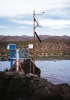
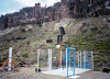
By January 1996, forty-two stations were installed and operational. Fourteen stations are located on mountain tops, 16 are in the foothills, and 12 are on the plains. Helicopters were used to install the mountain-top stations. During the winter, almost all of the stations are inaccessible due to rugged terrain. The second stage, consisting of 23 additional stations, should be in place by late 1997.
The system has worked flawlessly since installation. No station has required repair, demonstrating the equipment’s ability to function in temperatures less than -15°C and in winds up to 100 km/h.
At each remote station, the sensors are measured by a CR10, with a unique program defined by its sensors and transmission requirements. The CR10s are programmed to read the sensors at varying time intervals, and alarm call-outs are customized for each sensor. The central station polls each remote station to view real-time or historical sensor measurements, to change the transmission period, or to change the alarm levels of each sensor. Typically the date, time, battery level, and sensor readings since the last transmission are sent in 20- to 32-byte packets. Additional output parameters such as maxima and minima can also be programmed into the CR10 from the central office. When an alarm transmission occurs, the control central operator can access real-time data immediately.
The CR10 controls power to the satellite transceiver with one of its control ports. By switching power to the Inmarsat-C transmitter or by shortening transmission periods, battery power is conserved. A solar panel provides power to the remote stations with battery backup for nighttime or periods of diminished sunlight. Continuous data records are a higher priority than data transmission. If the system battery voltage falls below a preset level, the CR10 turns the transmitter off until power recovers. This ensures power levels are maintained for continuous sensor measurement and data storage.
The dataloggers used in the remote stations have 64 Kbyte of data storage, allowing data collection and data transmission to be independent. Data can be collected hourly or as protocol demands. Scheduled data transmission occurs every 4 to 6 hours; alarm transmissions occur randomly as needed. Datalogger clocks are updated daily through the Global Positioning System incorporated in the Inmarsat-C, ensuring precise timekeeping.
Electronica Naval developed the control and communication programs to transfer data from the network to the control station. The pooled data can be printed, used to produce charts and tables, or incorporated into AIC forecast models. Future plans include adding sensors to remote stations and control mechanisms or bypass valves to dams.
案例总结
应用
Monitoring growing conditions in different agricultural regions of a large country位置
West central Argentina使用的产品
CR10 CS106 CS105 Q7.1-L CS700 014A-L 024A-L HMP35C-L CS405-L贡献者
Daniel Garcia Neder Electronica Naval, S.A.参与机构
Autoridad Interjurisdiccional de las Cuencas de los Rios Limay, Negro y Neuquen (AIC)测量参数
Water level, wind speed/direction, precipitation, barometric pressure, temperature/RH, net radiation查看PDF